Search
Gloucester River
Things To Do Gloucester, Mid-Coast, New South Wales
Natural Attractions
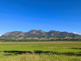
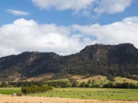
Gloucester River is one of several major rivers born in the high altitude wetlands of Barrington Tops, the highest point of the Barrington Coast.
On this high plateau, the eroded remains of an ancient shield volcano – there are snow gums and cool temperate rainforests of Antarctic beech perched high above the steep valleys.
The Gloucester, Barrington, Manning and Karuah Rivers are formed on Barrington Tops and as their crystal clear waters tumble from the rugged peaks, they breathe life into the land; for this is the Barrington Coast – a place where the leaves touch the waters from the mountains to the sea.
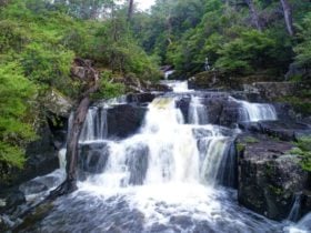
The Gloucester River is formed in the plateau above the beautiful cascades of Gloucester Falls. It flows eastwards for 102 kilometres and descends 1,150 metres before joining the Manning River at the village of Bundook.
The Gloucester River starts as a rugged mountain river then transforms to a calm and beautiful waterway passing verdant farmland in its lower reaches. It lends a lot of this beauty to the township of Gloucester where it’s joined by the Barrington River and Avon River.