Search
Walpole and Nornalup Inlets Marine Park
Things To Do Walpole, Manjimup, Western Australia
Natural Attractions
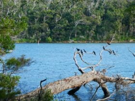
This marine park covers the Walpole and Nornalup Inlets. It also includes the tidal parts of the Frankland, Deep and Walpole rivers. These rivers also feed into the estuary system.
Come and explore these connected inlets. Walpole Inlet is shallow (at most 1m deep) while Nornalup Inlet is larger and deeper (up to 5m). The estuaries are joined by a natural 1km long and 2m deep channel, bordered by steep granite hills and rocky shores. These are known locally as ‘The Knolls’. They look pretty as a picture cloaked with dense karri, marri and tingle forest.
The park’s nature, wildlife and scenery offer a wealth of opportunities for canoeing, boating, windsurfing, fishing and other water-based activities. You can launch your boat or canoe at Rest Point, Coalmine Beach boat ramp, Walpole town jetty, Isle Road and Nornalup.
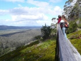
It’s great to picnic and chill along the shores of the marine park. Make use of the picnic tables and barbeques at Coalmine Beach, The Channels and Sandy Beach. There is a lookout at The Knolls and the Bibbulmun Track runs alongside the edge of the marine park for a short distance.

Facilities
Carpark
Picnic Area
Public Toilet
Activities
Fishing Hiking Scenic Drives Snorkelling Swimming WalksRates
Free Entry